Tour Explore / Races / Giro d'Italia 2020 Measured route guide
Giro d'Italia 2020: stages, elevation, and climbs 20 published stage routes covering 3,424 measured kilometers and 81,202 meters of cumulative elevation gain.
Explore this race on the interactive map Stage-by-stage route guide Stage 2 · hilly Alcamo to Agrigento
Distance 148.6 km
Elevation gain 2,856 m Stage 3 · mountain Enna to Etna
Distance 147.4 km
Elevation gain 4,380 m Stage 4 · flat Catania to Villafranca Tirrena
Distance 136.8 km
Elevation gain 3,305 m Stage 5 · hilly Mileto to Camigliatello Silano
Distance 221.1 km
Elevation gain 8,286 m Stage 6 · flat Castrovillari to Matera
Distance 172.8 km
Elevation gain 3,892 m Stage 7 · flat Matera to Brindisi
Distance 142.4 km
Elevation gain 653 m Stage 8 · hilly Giovinazzo to Vieste
Distance 202.0 km
Elevation gain 4,446 m Stage 9 · mountain San Salvo to Roccaraso (Aremogna)
Distance 194.5 km
Elevation gain 5,583 m Stage 10 · hilly Lanciano to Tortoreto
Distance 177.2 km
Elevation gain 2,747 m Stage 11 · flat Porto Sant'Elpidio to Rimini
Distance 183.2 km
Elevation gain 1,787 m Stage 12 · hilly Cesenatico to Cesenatico
Distance 202.8 km
Elevation gain 5,106 m Stage 13 · hilly Cervia to Monselice
Distance 188.8 km
Elevation gain 1,278 m Stage 14 · time trial Conegliano to Valdobbiadene
Distance 34.1 km
Elevation gain 658 m Stage 15 · mountain Base Aerea Rivolto to Piancavallo
Distance 174.2 km
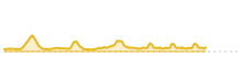
Elevation gain 4,341 m Stage 16 · hilly Udine to San Daniele del Friuli
Distance 225.5 km
Elevation gain 6,009 m Stage 17 · mountain Bassano del Grappa to Madonna di Campiglio
Distance 202.6 km
Elevation gain 8,912 m Stage 18 · mountain Pinzolo to Laghi di Cancano
Distance 206.5 km
Elevation gain 9,748 m Stage 19 · flat Morbegno Abbiategrasso to Asti
Distance 261.0 km
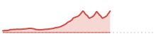
Elevation gain 3,762 m Stage 20 · mountain Alba to Sestriere
Distance 186.3 km
Elevation gain 3,437 m Stage 21 · time trial Cernusco sul Naviglio to Milan
Distance 15.8 km
Elevation gain 20 m How the terrain figures are calculated Tour Explore calculates the route distance, elevation gain, highest point, and profile from GPX geometry. Organizer-published distance and course classifications remain separate from these measurements, making discrepancies visible instead of replacing one figure with another.
 Stage 2 · hilly
 Stage 3 · mountain
 Stage 4 · flat
 Stage 5 · hilly
 Stage 6 · flat
 Stage 7 · flat
 Stage 8 · hilly
 Stage 9 · mountain
 Stage 10 · hilly
 Stage 11 · flat
 Stage 12 · hilly
 Stage 13 · hilly
 Stage 14 · time trial
 Stage 15 · mountain
 Stage 16 · hilly
 Stage 17 · mountain
 Stage 18 · mountain
 Stage 19 · flat
 Stage 20 · mountain
 Stage 21 · time trial